
On the Road with Hannah, Part 2: Interior Excursion
by Hannah Pembroke
Hello wildlife lovers! We are back on the road this week to kick off the second leg of our series. Leaving from Anchorage once again, we are headed upward and inward to the heart of Alaska: the interior region! This area has long been home to speakers of the Tanana Athabascan language, and many of the places we will visit were first named in this dialect. We will continue to explore the many landscapes and towns Alaska has to offer, specifically any location named after one of our many furry, feathered, or scaled friends. This week, we have a water-logged adventure scoped out, with three out of four stops being rivers. Without further ado, let’s get on the road and see where this trip takes us!
Little Salcha River

Grab your fishing pole! For our first stop, we will be East of the Tanana River, traveling along the Little Salcha River. This beautiful body of water received its first published name in 1906 by the U.S. Geological Survey (USGS) as "Little Salchaket River," however it has been the home of abundant wildlife and the Tanana Athabascan people for much longer. The river’s first name, given by the Tanana Athabascan people, was Tso' Ten No', or “beaver trail creek.” The Salcha River State Recreation Site will give plenty of water access and an opportunity to nature watch, up close and personal! This clear water tributary is home to a wide variety of Alaskan wildlife, including the beavers that it was originally named for. As we travel along the water, we will have to keep a special lookout for any dams built by the river’s namesake.
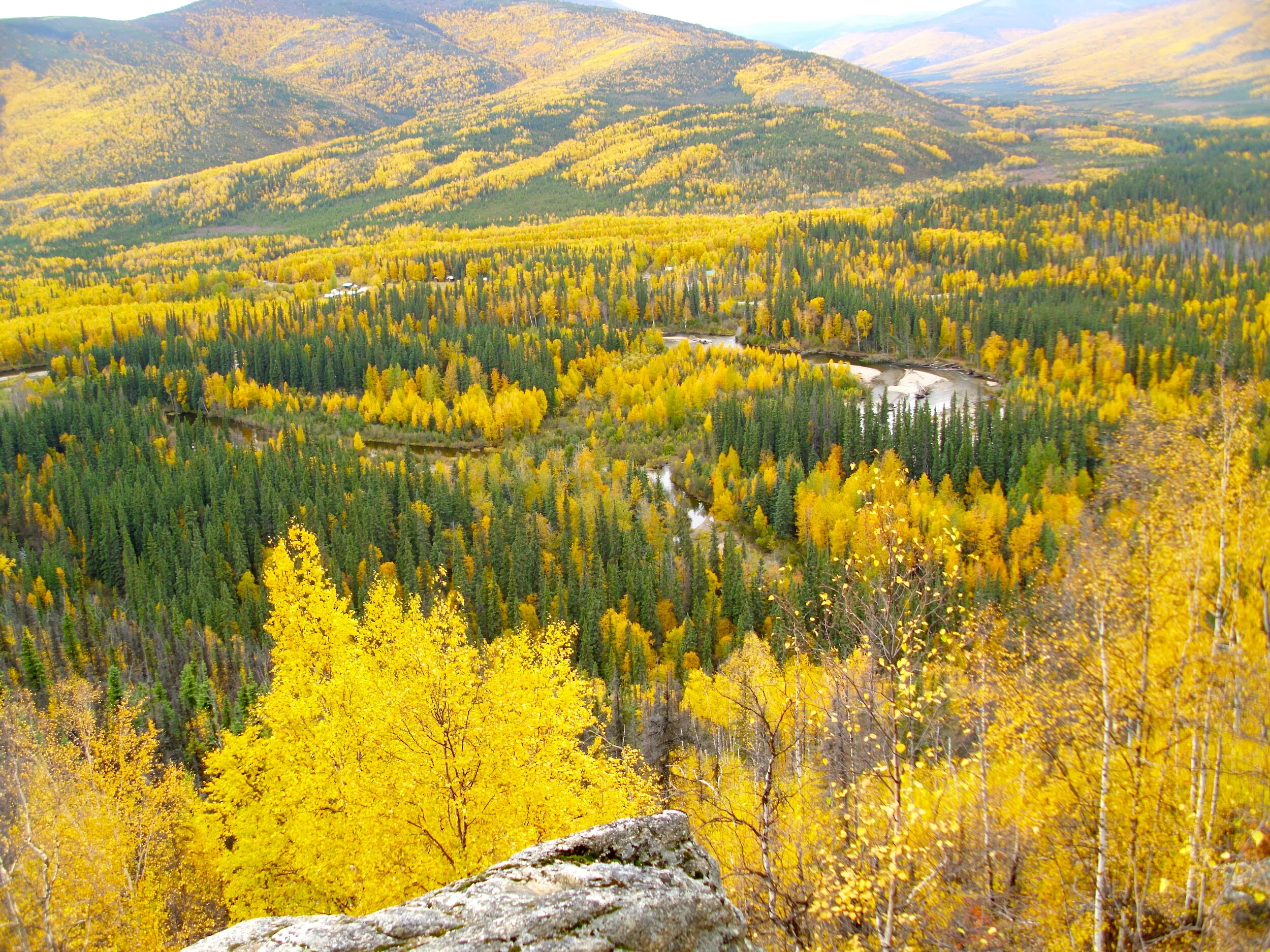
Clear Creek Butte

Clear Creek Butte (Image Credit: Jay C. Published on https://yak.spruceboy.net/)
Next up we will be hopping across the Tanana River to Clear Creek Butte. With an elevation of 876 feet, I hope you packed some good snow gear because, to fully appreciate the Butte’s Tanana Athabascan name, Ch'eyona' T'wx, or “bald eagle nest,” we will have to ski, snowshoe, or snowmachine to reach the summit. Clear Creek Butte’s original name is truly fitting. At the summit, we will be welcomed with a bird’s eye view of the Alaskan Range, where we can break out our binoculars and watch for wildlife, or simply enjoy the spectacular views. Surrounded by the Chena Ridge, our best route will be to take the Bonnifield Trail. This will take us to, and even past the Butte to optimize our chances at seeing wildlife. With this location being named after a bald eagle’s chosen place of nesting, make sure to keep your eyes to the sky- our chances of seeing some flying friends are high.
Chena River
Chena River State Recreation Area, Wikicommons
Our third stop takes us just outside of North Pole. Chena River’s Tanana Athabascan name, Ch'eno', literally translates to “river of something (game).” This is a reference to the importance of the land surrounding the water and how beneficial this location is for large game hunting. The translation may not specify which animal the lake is named for, but that’s not for lack of choices! Chena River and the surrounding land is a hot spot for moose and caribou. Caribou herds are commonly seen throughout the lower Chena Valley, so keep your eyes open on the drive to the water. If we choose to follow this river from start to finish, it will lead us through 100 miles of gorgeous Interior Alaska wilderness. As a tributary of the Tanana River, the Chena River draws wildlife from its beginning in the White Mountains, all the way to its end. In the summer it is ideal for kayaking and fishing, so don’t be afraid to mark this spot on your map for water and wildlife adventures year long!
Chatanika River

Last but definitely not least, we will be jumping up just North of Fairbanks to the Chayanika River. This winding and curved river was first named Dradlaya Nik'a, by the Tanana Athabascan people, which translates to “round whitefish river.” For this stop, embracing our inner fish and floating along the river is a must. Chatanika River is a popular canoeing location, but as fun as boating may be, the fishing is better. While a hot spot for Arctic Grayling throughout its water, the Chatanika River is also home to lamprey, burbot, humpback whitefish, northern pike, sheefish, and a small run of king, silver and chum salmon in the fall. It comes as no surprise that the river’s traditional Athabascan name is inspired by fish when we look at the abundance of food and sustenance the water provides. Even during the Alaskan Gold Rush, the Chatanika River was used to support the influx of population. It wasn’t until 2002 that the many dams and man-made structures that limited the flow of the river were torn down, allowing the water to flow freely and return to its original glory. Since it’s our last stop for this week, let’s take a moment to appreciate this river’s resiliency and its ability to support the abundant types of fish Alaska has to offer.
Thank you for checking in this week for the Interior leg of our journey! As always, it is a privilege and joy to experience the land around us and to witness wildlife in its natural habitat. If you are interested in aiding our goal of protecting Alaskan wildlife, please become a member for just $35 a year. See you next week, when we are back on the road with Hannah!
